APRIL 28, 2026 – Some time ago I wrote here about my directional disorientation during a family trip to Korea in 2000. I constantly confused the east coast of the Korean Peninsula with the west coast. Whenever I saw or heard mention of one side or the other, my brain would confuse it with the opposite side. This confusion surprised me, since I’ve always had a reliable internal compass.
Among my earliest learning memories of the world beyond the end of my nose were the points of the compass. Doubtless I was heavily influenced by my exposure to maps, especially the large framed children’s map of New Jersey—my mother’s home state—that hung on the wall of my bedroom. Before I fell asleep during my daytime naps, I’d run my eyes along the state border, and each time I reached the lower right side, I’d see the large decorative compass with points N, S, E, and W.
Another early influence on my sense of direction was Dad’s habit of referring to geographic features by their relative directional positions, such as, “The twin pines on the west side of the cabin.”
By kindergarten, my mental compass was well established. For weeks leading up to our family’s Christmas vacation road trip “Down South,” the evening family ritual, it seemed, was to gather round the dining room table and pore over road maps and other materials that my parents had procured from AAA. I knew full well that within the U.S., at least, Minnesota was “up” and “north,” and where we were going was “down” and “south.” In fact, on the first day of school after vacation, Miss Squires, my kindergarten teacher, invited me during “show and tell” to talk about our trip. To get things rolling, she said, “Eric, why don’t you tell the class where you went on vacation?” I knew the difference between “Down South” and “South America,” but I said the latter, thinking my classmates would be more impressed by the continent than by a region within our own country. And technically, I thought, I’d be correct. But when I uttered “South America,” Miss Squires corrected me.
“No, I don’t think so,” she said, sharply enough to make it sound like a reprimand.
Busted, I thought. But then I deigned to argue the point. “Yeah, but we went south,” I said, “and we were in America, so we were in ‘South America.’” Miss Squires didn’t buy it. You had to get up early to fool her.
So, anyway, back to Korea in 2000. I simply could not get “east” and “west” right. At the base of my situational directional dyslexia was the fact that from my customary vantage point (Minnesota), California was “way out west,” and if you kept sailing or flying west from “way out west,” you eventually reached Japan, then Korea. Of course, it would be Korea’s east coast, but that didn’t alter the fact that it was farther west than California, which, again, was “way out west.” Thus, Korea’s east coast was fixed in my mind as “west,” which meant that the opposite coast was . . . Korea’s east coast.
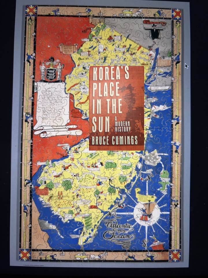
This morning I discovered that my directional disability—as regards Korea, anyway—might well be shared by Bruce Cumings, a leading American scholar of modern Korean history. While reading one of his books, Korea’s Place in the Sun (1997) I encountered the following sentence: “Parhae [. . .] kept Silla forces permanently below a line running from present-day P’yōngyang in the east to Wōnsan in the west.” I read it three times to make sure I was reading accurately, its inaccuracy: I had adequate familiarity with Korea’s geography to know that P’yōngyang, capital of North Korea, lies on the west side of the country and that Wōnsan is positioned on the east coast. I couldn’t allow this error to pass. I grabbed a pencil, crossed out “east” and “west” as they appeared in the sentence and printed “west” and “east” above them respectively.
Now here’s the crazy thing about it all. When just now I wrote the sentence above starting with “I had adequate familiarity with Korea’s geography . . .” guess what happened initially? I typed “P’yōngyang . . . lies on the east side . . .”! Even when I’m thinking about my “disorientation,” my brain insists on reversing Korea’s east with the country’s west!
Which brings me to another matter of directional confusion. Recently, while Artemis II was going long around the moon, I saw an image of earth taken by the crew from a vantage point that was still relatively close to earth. What amazed me was that I couldn’t identify what part of terra firma, bordered on two sides by ocean waters, was showing in the photograph (whatever continent appeared was largely under cloud cover). Speaking of “terra firma,” I have as firm a grasp of continental shapes as I do of each state in the U.S. Yet, for the life of me, I couldn’t place the land in the photograph; a large chunk of earth that narrowed to a point, with no other land masses nearby.
Only days later when I happened to glance at our living room globe tilted 45 degrees on its floor stand did I instantly see what had appeared in the Artemis II photograph: the tapered bottom third or so of South America.
I found this experience unsettling. Here I am, I thought, an old guy who’s looked at hundreds, perhaps thousands of world maps; who’s travelled widely—around the world, even—and who always aced the geography category in Trivial Pursuit; the guy who knows north from south (even if he occasionally has trouble with “east” and “west”) . . . and yet . . . and yet . . . tilt the world sideways and I’m as good as lost in space.
This phenomenon has a much larger dimension. I realize how my brain became so fixed by habit, by culture, I’d lost the ability to adjust, to adapt, to change; I’d reached the point of closing off entirely, alternatives to habit and ossified thinking. Why is it that invariably, I think of north as “up” and south as “down”? Why do I always depict and “see” in my mind, Alaska as “high” and Tierra del Fuego as “low”? In outer space, there is no fixed “up” or “down,” and yet, down here on earth, those directions are etched indelibly into our bias. Similarly, Japan and Korea down to Indonesia is called “East” Asia by us “Westerners.” But on a sphere, who’s to say that one way is “east” and the other way is “west” when you can reach both in each direction?
I should note, however, that while traveling “Down Under” decades ago, I ran into maps that did depict our world in a fashion that we Northerners would call “upside down.” With tongue in cheek, the Aussie and Kiwi purveyors of such maps slapped the phrase, “Up and Over,” boldly across the top. Australia and New Zealand, of course, were sailing high above the rest of the world.
Those maps were a reminder that if my directional bias was in fact “upside down,” perhaps I held many other biases that were likewise open to challenge. Unfortunately, in good time after my return to Minnesota, I re-conformed to a good many homegrown norms. My recent experience with the Artemis II photo and my ongoing (apparently) reversal of Korea’s “east” and “west” are reminders that I need to break out of my geographic limitations—and other forms of myopia—more often. Perhaps my condition would improve if I stood on my head 10 minutes a day while looking at an American-published wall map of the world. Or, in keeping with the overall lesson here, I could sit right-side up in a chair while looking at the wall map hung upside down.
Subscribe to this blog and receive notifications of new posts by email.
© 2026 by Eric Nilsson