AUGUST 20, 2026 – (Cont.) A few miles north of Bayfield we entered the Red Cliff Band of Lake Superior Chippewa Indian Reservation. The first notable sight is the Legendary Waters Resort and Casino right on the shore of Lake Superior. Having hit the jackpot with the weather, however, we proceeded past this establishment several minutes to the turn-off onto “Blueberry Road.”
Blueberry Road is a ribbon of asphalt that rises and falls past undulating wooded terrain interrupted by an occasional residence. The speed limit was 35 mph, which was tempting to exceed, given the lack of traffic, but out of respect for the local residents, we stayed close to the posted limit. At a curve in the road was small sign and easy-to-miss turnoff—so easy to miss, I did just that, before Beth said, “There it is!”—for “Frog Bay Tribal National Park,” where splendid hiking opportunities existed according to our licensed tour guide (Beth, who is licensed to drive and sufficiently organized to be a universal guide).
At the trailhead was a small parking area and information board stocked with simple but helpful three-panel brochures that included a small-scale hiking map superimposed on an aerial photo of the park. With Byron in charge of the (initially) napping kids, the rest of us intrepid hikers set out on the “Easy Trail,” named according to its level of difficulty, described as “easy route to beach via an access road.” Its designated length was just 0.4 mile. This trail narrowed to the “Beach Trail,” 0.25 mile to . . . an improbable beach.
I say “improbable,” because as a native Minnesotan, I grew up associating Lake Superior with the “North Shore”—that is, the Minnesota shoreline that stretches along a fairly straight line from Duluth, at the extreme western point of the lake, to Grand Portage, 146 miles to the northeast, on the border with Ontario. In most places, the North Shore is rocky and rugged, often reminiscent of the coast of Maine, and known for its wild and wooly aspects—abundant waterfalls, chasms and rockbound shoreline. The only “beach” along the North Shore is one of stones.
Not until I was well into adulthood had I traveled along Wisconsin’s South Shore of Lake Superior, where traditional sand beaches are more common. Perhaps the longest, most impressive sand beach of all runs along the south shore of Madeline Island, which itself is reachable by the regularly running car ferry from Bayfield.
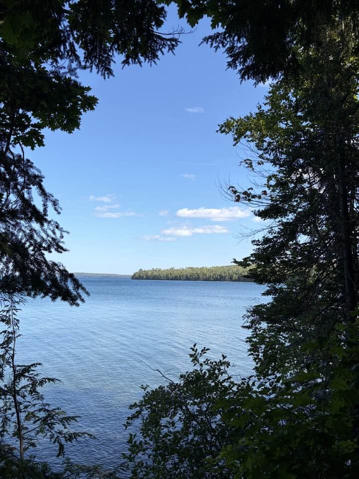
In any event, now in Frog Bay Tribal National Park—the first tribal national park in the U.S.—we came upon a beautiful sand beach stretching as far as the eye could see in either direction along the lakeshore. Only a handful of people occupied the beach, and none close enough or long enough to engage. No sign of civilization appeared within sight. Across a mile and a half of tranquil water lay uninhabited Oak Island, roughly four miles in length and three in width, with a significant ridge running lengthwise along the center. Together with the other 21 islands of the archipelago comprised by the Apostle Islands National Lakeshore, Oak Island is protected from development.
After absorbing the soul-enriching lacustrine scenery, we resumed our hike. By quick consensus we chose the “moderately difficult” one-mile-long “Ravine Trail,” which meanders back around to the parking area. This trail led away from the lakeshore and into a deep, dark forest filled with luxuriant hemlocks and balsam fir, accompanied by white cedars and birches. The flora here is markedly different from (more boreal than) our pine, oak and maple woods back at Björnholm on the shores of Grindstone Lake—a 3100-acre body of water, yet a mere pond compared to Gitche Gumee, the Big-Sea-Water.
The well-traveled trail runs up and down and all around, and for much of it, roots bend and twist over the surface as if set by forest trolls in a prankish effort to trip any intruder who ignores the inherent condition best described as “Toe-Stub Zone.” The constant risk of stumbling, however, served as a welcome governor on the customary freneticism of modern life. Each frame of vision was part of an uninterrupted scene of untainted beauty; each step a reminder of our miraculous connection to this planet, so small on a cosmic scale, yet infinite in the arrangements of its features—unique as far as our far reaching technology yet knows.
Before trail’s end, it was a joy to see Byron approach from the opposite direction—his seven-month “smiley girl” strapped in. Cultivating a legacy of good environmental stewardship starts with keeping young children attuned to nature. Developing an affinity for nature in all its wonders and beauty is as critical to sustenance of the soul as fresh fruit and vegetables are to nourishment of the body.
After completing our grand hike, we drove south, through Bayfield and on to Houghton Falls Preserve on the way to Washburn. Beth and I had hiked there several years ago but stayed behind this time in case the rest of the party—kids included—couldn’t reach their destination (Gitchi Gummi!) and return in less than an hour, when the automatic gate to the parking area would close. Our role was to remain on hand to move the cars just outside the gate—to avoid the posted (“minimum”) fee of $100 if you’re caught inside the gate after 18:59.59 and have to call the sheriff’s office to be released “from jail.”
This woods too was a splendid showcase of nature’s grandeur—except, sadly, the creek that feeds the rapids and waterfalls along its usual course had dried up in the current drought. I headed out on a 10-minute walk along the trail and marveled at the effort of trail-builders, who for hundreds of yards had laid down rows of three-inch-thick, eight-inch-wide timbers (Doug fir, if I could guess), creating a virtual highway for hikers—especially those with vulnerable big toes.
Along the way I encountered a young couple clad in bathing suits and wrapped in towels, returning from the Superior terminus of the trail. “How was the water?” I asked.
“It was fine,” said the man. “And not very cold, either.”
I found his report unsettling. Lake Superior is—or always was—notoriously cold. I remember when our Czech friend, Pavel, leaped into the lake near Splitrock Lighthouse on the North Shore. During a visit to Björnholm in 1988, he disclosed that ever since he was a young kid he’d dreamt of swimming in Lake Superior. Now a young heart surgeon on leave from a stint at the Ochsner Clinic in New Orleans, he’d traveled to the Northland. After climbing down the trail from the lighthouse to the rocky shore, Pavel stripped down to his underwear and after the count of three, plunged into the calm but frigid waters. He swam four or five strokes out, let out a wild “Whoop!” then swam straight back. He was elated (and I was relieved). He’d done it. He’d swum in the Big-Sea-Water at the geographic center of North America.
But now, a couple swims in the same body of water, and the man tells me it’s “not very cold”? I wondered if that assessment was related to the creek having run dry—and our own lake, Grindstone Lake and surrounding lakes—being chronically low. I noticed too that the need for the thick timber walkway through the preserve—normally somewhat marshy terrain—wasn’t necessary, at least for the time being. And I worried. What’s happening to our precious planet? And how fast and to what end . . . and why[1]?
With five minutes to spare before “jail time,” we heard voices, and a minute later, our gang came dashing down the timber walkway to the parking lot. By the time everyone was strapped in and the rear bumper of each of our cars was clear of the gate, we still had a minute left on the clock.
Ninety minutes later, we pulled up to the back of the Red Cabin, edified by the day’s expedition.
Subscribe to this blog and received notifications of new posts by email.
© 2026 by Eric Nilsson
[1]If anthropogenic, it’s our individual and collective duty to do all we can to decelerate our voracious appetite for fossil fuels and to accelerate development of and reliance on true (and green) renewables. Of course, in the case of any given weather system or condition, when teasing out the causal relationship between the system/condition and climate change, the empirical evidence can be complex and less than perfectly definitive (with the usual percentage of outlying data). But with more data, more patterns become discernible, a nexus more evident. Meanwhile, the pot boils. That much is a certainty.
