NOVEMBER 29, 2022 – (Cont.) Dad put extra peanut butter in our sandwiches, since our rained-out breakfast had left us hungry. I remember walking around, eating my sandwich and holding a cookie, as I admired the lofty Norway pines that encircled our landing spot.
In the short time of our lunch break, however, a breeze had picked up, giving chop to the water. “We’d better be off,” Dad said, as he stuffed the last of his sandwich into his mouth and chased a couple of napkins that had taken flight toward the pines. I downed my cookie and helped him pack things up. Before heading out, we secured the flapping tarps over the top of the canoe.
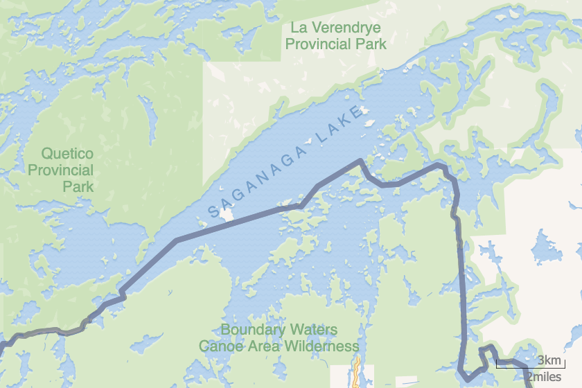
Soon a light rain was again falling, limiting visibility as we ventured toward the “Big Water”—Lake Saganaga. We had long daylight, at least, since we were much farther north than the Twin Cities or even our family’s cabin in northern Wisconsin. But the thick clouds hung so low, the surrounding wilderness looked dark and forbidding. Only the outline of the forest treetops along the shore made any kind of visible impression.
Eventually the Granite River opened into “Sag,” as veteran Boundary Waters call the “Big Water.” I don’t have a clear memory of it, probably because in the continuing mist, nothing was very clear, except that we were a long way from civilization. We’d encountered only two or three canoes over the previous several days, and now on Sag as well we seemed to be alone.
Since I was sitting in the bow, I saw none of what Dad saw of the canoe and the tarps over our cargo. We hadn’t gotten far into Saganaga, however, when Dad said he couldn’t see the map where he typically tucked it between the tent bag and the Coleman stove, now barely visible under the edge of a tarp.
I turned around right when Dad stopped paddling. He placed the shaft across the gunwales with one hand and and leaned forward to wedge his other hand between the tent and the stove in search of the map. He then looked up and resumed paddling but with worry on his face. “We’d better paddle over to that island ahead,” he said, “so we can find the map and our bearings.”
I put my paddle blade back in the water and pulled. What if we couldn’t find the map? I thought, as Dad’s worry became my own. And his worry deepened as he tried to recall every moment of our lunch stop, where he’d last looked at the map.
“I know I had it out after I’d fixed our sandwiches,” he said. “I was sitting on that big rock. But then what? Did you see it?”
“Not after you were looking at it,” I said.
“I’m sure I tucked it back in its place,” he said. “I wanted to make sure it would stay reasonably dry, but . . .”
“But what?”
“I’m not sure if I put it back. Remember when the napkins blew away?”
“Yeah.”
“Was that before or after I’d put the map away?”
“I dunno. I think maybe . . . I can’t remember.” (Cont.)
(Remember to subscribe to this blog and receive notifications of new posts by email.)
© 2022 by Eric Nilsson